01 · TATIKUCHI
Weavers
The source associates the name with weaver families who migrated southward and settled near the present Barpeta Kirtan Ghar area.
A digital journey through a historic landscape shaped by the Barpeta Satra, Vaishnavite tradition, rivers, communities, resistance and generations of memory.
The source history describes Barpeta through place, faith, rivers, land, wildlife, climate and people. Its story is closely connected with the spread of Ekasarana Vaishnavism and the cultural world of the satras.
The source places the Barpeta region in the lower Assam Valley, between approximately 26°2′–26°50′ north latitude and 90°40′–91°24′ east longitude. It describes Bhutan to the north, the southern bank of the Brahmaputra to the south, Nalbari to the east, and Kokrajhar and Bongaigaon to the west.
উত্তৰ-পূৱ ভাৰতৰ অসম উপত্যকাৰ নামনি ভাগত বৰপেটা অঞ্চল অৱস্থিত। উত্তৰে ভূটান পৰ্বত, দক্ষিণে ব্ৰহ্মপুত্ৰ, পূৱে নলবাৰী আৰু পশ্চিমে কোকৰাঝাৰ-বঙাইগাঁও অঞ্চল ইয়াৰ ঐতিহাসিক ভৌগোলিক পৰিচয়ৰ অংশ।
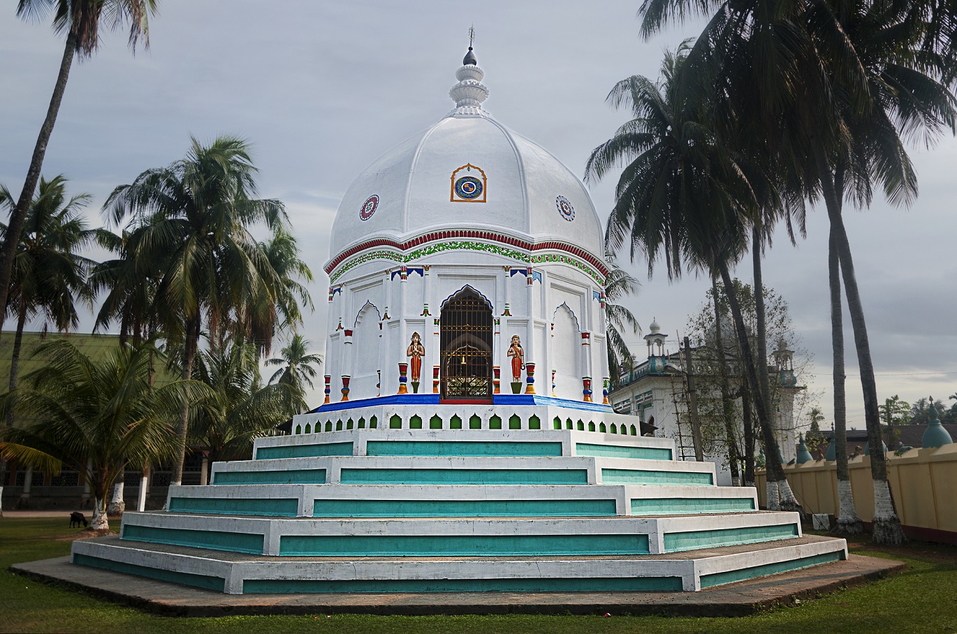
The historical account presents Barpeta as a major Vaishnavite centre. The influence of Shrimanta Sankardeva and Madhavdeva helped shape its religious and cultural identity, with satras becoming important institutions of community, devotion and learning.
The source records ten historical names associated with the place: Tatikuchi, Porabhita, Mathura, Vrindavan, Choukhutisthan, Nabaratna-Sabha, Icchakuchi, Pushpak Vimana, Kampur and Barpeta. Some were used in different periods or contexts.
তাঁতীকুছি · পোৰাভিঠা · মথুৰা · বৃন্দাবন · চৌখুটিস্থান · নৱৰত্নৰ সভা · ইচ্ছাকুছি · পুষ্পক বিমান · কামপুৰ · বৰপেটা
The account connects Tatikuchi with weavers who migrated from upper Assam; Porabhita with the Chunpora Bhitha area associated with Sankardeva; Mathura with Madhavdeva and Mathuradas; and Vrindavan with a remembered landscape where Madhavdeva sang Krishna-related devotional songs.
The source associates the name with weaver families who migrated southward and settled near the present Barpeta Kirtan Ghar area.
The name is linked to the site where Shrimanta Sankardeva is said to have established a satra for a period.
Madhavdeva's association with the area and his disciple Mathuradas are central to the traditional explanation.
The source connects the name with Madhavdeva's devotional experience near Barpeta Bil and the later name Vrindavanhati.
Four boundary markers around the early satra are described as giving rise to the idea of a place of four limits or khuti.
The source describes gatherings of nine respected ata figures around Madhavdeva, associated with devotional discussion and religious work.
The source says the name Barpeta appears in the Guru Charit traditions associated with Ramcharan Thakur and Daitari Thakur. One interpretation connects it with the religious “pat” or seat established by Madhavdeva, becoming “Barpat” or “Barpata” as the place grew into a principal religious centre. Other traditions connect the name with a large wetland or the Brahmaputra's watery landscape.
The historical account describes Barpeta as largely level and alluvial, with sand and silt deposited by rivers. River islands or chars could appear and disappear as channels shifted. It also records the major earthquake of 12 June 1897, after which parts of southern Barpeta reportedly subsided several feet, riverbeds rose, and severe flooding became more frequent.
The source also mentions major earthquakes in 1584 and 1642 in historical accounts, and says the epicentre of the 1897 earthquake was near Barpeta town.
The source highlights the Manas, Chaulkhowa, Beki, Kaldia, Pahumara, Nakhanda and Palla river systems. Manas historically served as an important frontier river and water route. Chaulkhowa was a significant historic channel, while Beki became broader and faster-flowing after changes in the course of the smaller Manas. Kaldia and Pahumara supported historic trade with Bajali when road connections were limited.
The account also remembers older wetlands and beels, including Kapla, Sarbhog and several smaller water bodies, as part of Barpeta's historic ecology.
Historic wetlands supported fish, waterbirds and seasonal movement, while changing river channels continually reshaped the land.
The source lists many native trees and describes bamboo and cane as abundant in northern and central areas, with valuable timber species in reserved forests.
The account records storks, herons, ducks, kingfishers, snipes and many resident and migratory birds, while noting that numbers declined over time.
Manas is described as a refuge for rhinoceros, wild buffalo, golden langur, elephants, deer, wild dogs, clouded leopards and other species.
The source describes Mathanguri as a peaceful natural destination beside the Manas River, reached by road from Barpeta Road.
The historical record mentions limestone discovered near the Bhutan foothills in 1871 and older references to gold particles in Brahmaputra and Manas sands.
The source's historical gazetteer descriptions portray winters as cool and foggy, spring as pleasant, summers as moderate but humid, and the monsoon as the dominant wet season. It also divides the year into winter, pre-monsoon storms, southwest monsoon and post-monsoon periods.
The source also notes the growth of Barpeta town from an estimated 1,500 people in 1735, to around 3,000 when the subdivision headquarters was established in 1840, 11,332 in 1881 and 26,479 in 1971.
The source's historical summary places the region under the Varman, Salasthama, Pala, Kamata and Koch periods, followed later by Mughal and British administration.
Koch rule shaped the region, with Naranarayan associated with Barnagar and with the religious history of Sankardeva's Vaishnavite movement.
Sankardeva and Madhavdeva's religious and cultural influence turned Barpeta into a major centre of Ekasarana Naam Dharma and satra life.
A copper-plate reference cited by the source records 297 households of bhakats and paiks associated with Barpeta Satra, giving an estimated population of about 1,500.
Barpeta became a subdivision headquarters around 1840, followed by the Mouzadari system under British administration in 1841.
The source connects increased land-revenue demands with unrest, including the Lachima uprising.
A major earthquake reshaped parts of the southern landscape and contributed to later flooding problems.
The source records the formation of the Manas sanctuary on 1 October 1928, followed by later recognition as a tiger project and proposed national park.
The English historical summary records Mahatma Gandhi's visit to Barpeta in 1934.
The same historical summary records Jawaharlal Nehru's visit in 1937.
The source highlights local participation and identifies Madan Chandra Barman and Rauta Koch among the first martyrs mentioned in its account.
The source lists leaders associated with Barpeta's freedom struggle, including Umesh Chandra Brahmachari, Dhaniram Talukdar, Ganesh Lal Choudhury, Debendra Nath Uzir, Akshay Kumar Das, Bongshidhar Choudhury, Nanamohan Mazumdar, Golak Pathak, Sonaram Choudhury, Dr. Jinaram Das, Biswanath Das, Praneswar Das, Ambikagiri Raichoudhury, Mahendra Mohan Choudhury, Madhusudan Das, Upendra Chandra Das, Debendra Sharma, Naranarayan Goswami, Kabiraj Ghanashyam Das and Chandraprava Saikiani.
The historical information presented on this page is based on the high-value historical book “Barpetar Buranji” by Mr. Digambar Das. This digital presentation has been created to make the historical, cultural and geographical information accessible in a modern web format while acknowledging the original author and source.
From satra traditions and river routes to forests, movements and changing communities, Barpeta's history is still being lived.
Explore HowlyTown